As-Suwayda District
as-Suwayda District منطقة السويداء | |
|---|---|
District | |
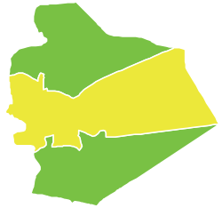 Map of as-Suwayda District within as-Suwayda Governorate | |
Coordinates (as-Suwayda): 32°42′N 36°34′E / 32.7°N 36.57°E / 32.7; 36.57Coordinates: 32°42′N 36°34′E / 32.7°N 36.57°E / 32.7; 36.57 | |
| Country | |
| Governorate | as-Suwayda |
| Seat | as-Suwayda |
| Subdistricts | 3 nawāḥī |
| Area | |
| • Total | 2,804.22 km2 (1,082.72 sq mi) |
| Population (2004)[1] | |
| • Total | 180,907 |
| • Density | 65/km2 (170/sq mi) |
| Geocode | SY1300 |
as-Suwayda District (Arabic: منطقة السويداء, translit. manṭiqat as-Suwaydā’) is a district of the as-Suwayda Governorate in southern Syria. Administrative centre is the city of as-Suwayda. At the 2004 census, the district had a population of 180,907.[1]
Sub-districts
The district of as-Suwayda is divided into three sub-districts or nawāḥī (population as of 2004[1]):
| Code | Name | Area | Population |
|---|---|---|---|
| SY130000 | as-Suwayda nahiyah | 691.13 km² | 212,463 |
| SY130001 | al-Mazraa nahiyah | 202.53 km² | 16,627 |
| SY130002 | al-Mushannaf nahiyah | 1,910.57 km² | 17,134 |
See also
- List of populated places in as-Suwayda Governorate
References
^ abc "General Census of Population and Housing 2004" (PDF) (in Arabic). Syrian Central Bureau of Statistics. Archived from the original (PDF) on 8 December 2015. Retrieved 15 October 2015..mw-parser-output cite.citationfont-style:inherit.mw-parser-output qquotes:"""""""'""'".mw-parser-output code.cs1-codecolor:inherit;background:inherit;border:inherit;padding:inherit.mw-parser-output .cs1-lock-free abackground:url("//upload.wikimedia.org/wikipedia/commons/thumb/6/65/Lock-green.svg/9px-Lock-green.svg.png")no-repeat;background-position:right .1em center.mw-parser-output .cs1-lock-limited a,.mw-parser-output .cs1-lock-registration abackground:url("//upload.wikimedia.org/wikipedia/commons/thumb/d/d6/Lock-gray-alt-2.svg/9px-Lock-gray-alt-2.svg.png")no-repeat;background-position:right .1em center.mw-parser-output .cs1-lock-subscription abackground:url("//upload.wikimedia.org/wikipedia/commons/thumb/a/aa/Lock-red-alt-2.svg/9px-Lock-red-alt-2.svg.png")no-repeat;background-position:right .1em center.mw-parser-output .cs1-subscription,.mw-parser-output .cs1-registrationcolor:#555.mw-parser-output .cs1-subscription span,.mw-parser-output .cs1-registration spanborder-bottom:1px dotted;cursor:help.mw-parser-output .cs1-hidden-errordisplay:none;font-size:100%.mw-parser-output .cs1-visible-errorfont-size:100%.mw-parser-output .cs1-subscription,.mw-parser-output .cs1-registration,.mw-parser-output .cs1-formatfont-size:95%.mw-parser-output .cs1-kern-left,.mw-parser-output .cs1-kern-wl-leftpadding-left:0.2em.mw-parser-output .cs1-kern-right,.mw-parser-output .cs1-kern-wl-rightpadding-right:0.2em Also available in English: "2004 Census Data". UN OCHA. Retrieved 15 October 2015.
This article about a location in as-Suwayda Governorate, Syria is a stub. You can help Wikipedia by expanding it. |

 Clash Royale CLAN TAG#URR8PPP
