Lai Châu Province
Lai Châu Province Tỉnh Lai Châu | |
|---|---|
Province | |
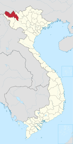 Location of Lai Châu within Vietnam | |
Coordinates: 22°0′N 103°0′E / 22.000°N 103.000°E / 22.000; 103.000Coordinates: 22°0′N 103°0′E / 22.000°N 103.000°E / 22.000; 103.000 | |
| Country | |
| Region | Northwest |
| Capital | Lai Châu |
| Government | |
| • People's Council Chair | Lỳ Khai Phà |
| • People's Committee Chair | Lò Văn Giàng |
| Area[1] | |
| • Total | 9,068.8 km2 (3,501.5 sq mi) |
| Population (2014)[1] | |
| • Total | 415,300 |
| • Density | 46/km2 (120/sq mi) |
| Demographics | |
| • Ethnicities | Tai, H'Mông, Vietnamese, Giáy, Dao |
| Time zone | UTC+7 (ICT) |
| Area codes | 213 |
| ISO 3166 code | VN-01 |
| Website | www.laichau.gov.vn |
Lai Châu (![]() listen) is a province in the Northwest region of Vietnam. Lai Châu Province is the most sparsely populated in Vietnam, and it shares a border with China. It was once a semi-independent White Tai confederation known as Sip Song Chau Tai, but was absorbed by France into French Indochina in the 1880s and subsequently became part of Vietnam following Vietnamese independence in 1954.[2][3] It became part of the Northwest Autonomous Area of the Democratic Republic of Vietnam from 1955 to 1975, when Lai Châu Province was formed. Điện Biên Province was carved out of Lai Châu in 2004.
listen) is a province in the Northwest region of Vietnam. Lai Châu Province is the most sparsely populated in Vietnam, and it shares a border with China. It was once a semi-independent White Tai confederation known as Sip Song Chau Tai, but was absorbed by France into French Indochina in the 1880s and subsequently became part of Vietnam following Vietnamese independence in 1954.[2][3] It became part of the Northwest Autonomous Area of the Democratic Republic of Vietnam from 1955 to 1975, when Lai Châu Province was formed. Điện Biên Province was carved out of Lai Châu in 2004.
Contents
1 Etymology
2 Administrative divisions
3 Languages
4 Economy
5 Infrastructure
5.1 Transport
5.2 Telecommunication
6 Climate
7 References
8 External links
Etymology
Sip Song Chau Tai is a Tai Lü compound consisting of sibsong "twelve" and chu "master". It is cognate to Template:Lang-t, and may rendered in English as "Twelve Tai Kingdoms" or "Chiefdoms", according to relative standing in the Southeast Asian mandala political model, in allusion to either a Chief of the Name or a tribal chief. Sibsong derives from Chinese 十 (ten) and 雙 (pair). "Chu", (rendered in Tai as จุ or in longer form เจ้า,) derives from Middle Chinese 主 (ćǘ) "master."
Administrative divisions
Lai Châu is subdivided into eight district-level sub-divisions:
- 7 districts:
- Mường Tè
- Phong Thổ
- Sìn Hồ
- Tam Đường
- Than Uyên
- Tân Uyên
Nậm Nhùn (newly created since 2012)
- 1 provincial city:
Lai Châu (capital)
They are further subdivided into seven commune-level towns (or townlets), 96 communes, and five wards.
Languages
Languages spoken in Lai Châu Province include the following.
Hmong–Mien languages- Hmong
Kra languages
Laha - Than Uyên
Tibeto-Burman languages
Sila - Mường Tè
Côông - Mường Tè
Lahu - Mường Tè
Hani - Mường Tè, Phong Thổ
Austroasiatic languages
Kháng - Mường Tè, Phong Thổ, Than Uyên
Economy

A bridge in Lai Châu Province
Lai Châu has long been the poorest province in Vietnam. It is also the least industrialised province. In 1974, the industrial output of Hanoi - the richest province in North Vietnam at that time - was 47 times as high as that of Lai Châu.[4] The province became even more backward after the more industrialised south was separated to become Điện Biên Province. In 2007, Hanoi's industrial output (before its merger with Hà Tây Province) was 93 times that of Lai Châu.[5] Industrial output has, however, grown rapidly in recent years, more than tripling between 2000 and 2007, making the fastest growing sector in the province compared to an agriculture and forestry sector that has grown by less than 50% and a service sector that has more than doubled in the same time.[5] Industrial products include liquor, bricks, cement and electricity. Industrial output in 2007 was 476.6 billion Vietnamese đồngs, accounting for 28.9% of the province's economy, compared to only 16.5% in 2000.
Lai Châu's main agricultural products (in 2007) are rice (99,900t), maize (35,000t), cassava (48,900t) and tea (16,532t). The production of rice and maize tripled since 2000, while the output of cassava and tea has been increasing by around 40% and 120%.[5] Tea from Lai Châu is sold to other provinces in Vietnam and also exported to other countries.
Lai Châu has a relatively large forestry sector with an output of 176.3 billion đồngs in 2007. It has, however, been far overtaken by the agricultural, industrial and service sectors and contributed little to recent growth. It has grown by only 1.66% in 2007 and 1.69% in 2006, after declining by almost 19% between 2000 and 2005.[5]
There are plans to exploit rare-earth elements in Lai Châu.
Vietnam's central government signed an agreement in October 2010 to supply Japan with rare-earth elements[6] in Lai Châu Province.[7] This is part of Japan's efforts to diversify its supply of rare earths and decrease its dependence on imports from China.
Lai Châu's economy grew by 14.56% in 2007, 12.3% in 2006 and 50.75% between 2000 and 2005.[5]
Infrastructure

Road construction works in Lai Châu province
Transport
National Road 4 connects Lai Châu to Lào Cai Province, National Road 12 to Điện Biên Province and National Road 32 to Yên Bái Province. There is also a road to Gejiu in China. There is neither an airport nor a railway in the province.
Road transport has grown rapidly in recent years. Freight traffic increased from 1 million tons.km in 2000 to 21.3 tons.km in 2007, while passenger traffic increased from 4.4 to 16.7 million passenger km.[5]
Road infrastructure is still not very developed. Only 19.36% of the roads in the province are paved and only 10.53% of respondents to a survey of local businesses think that road quality is good or very good.[8]
Telecommunication
As of 2007, there 22,100 telephone subscribers in Lai Châu, a significant increase from the 14,200 in the previous year.[5] Only 35.59% of the respondents to a survey assessed telecommunications quality as good or very good, the lowest value among all the provinces in Vietnam.[8]
Climate
- Annual average temperature: 23 degrees Celsius.
- Annual average rainfall: 2.5 m.
References
^ ab Statistical Handbook of Vietnam 2014 Archived 2015-07-06 at the Wayback Machine., General Statistics Office Of Vietnam
^ Forbes, Andrew, and Henley, David: Vietnam Past and Present: The North (History and culture of Hanoi and Tonkin). Chiang Mai. Cognoscenti Books, 2012. ASIN: B006DCCM9Q.
^ http://www.zum.de/whkmla/histatlas/seasia/haxlaos.html
^ Beresford, Melanie (2003): "Economic Transition, Uneven Development, and the Impact of Reform on Regional Inequality", in Luong, Hy V. (ed.): Postwar Vietnam: dynamics of a transforming society. Lanham, Maryland: Rowman & Littlefield
^ abcdefg General Statistics Office (2009): Socio-economical Statistical Data of 63 Provinces and Cities. Statistical Publishing House, Hanoi
^ "Rare earths supply deal between Japan and Vietnam". BBC News. 31 October 2010. Retrieved 31 October 2010.
^ "Vietnam signs major nuclear pacts". Al Jazeera. 31 October 2010. Retrieved 31 October 2010.
^ ab Vietnam Provincial Competitiveness Index 2009
External links
- Official Lai Châu Province website
| Wikimedia Commons has media related to Lai Chau Province. |
Places adjacent to Lai Châu Province | ||||||||||
|---|---|---|---|---|---|---|---|---|---|---|
| ||||||||||

 Clash Royale CLAN TAG#URR8PPP
